On July 25th 2020, the MV Wakashio ran aground on a coral reef approximately one kilometre offshore of the town of Pointe d'Esny, on the South-East coast of Mauritius.
The empty bulk carrier was 11 days into a voyage from Singapore to Brazil and was carrying approximately 3,900 tonnes of very low-sulphur fuel oil, 200 tonnes of diesel and 90 tonnes of lubricant.
On August 6th, the vessel began spilling oil and the Mauritian government declared a state of environmental emergency as the leak threatened protected ecosystems, including the Ile aux Aigrettes nature reserve and the Blue Bay marine park. Whilst the majority of the oil was pumped out before the ship broke apart on August 15th, an estimated 25% of the oil leaked into the sea.
This blog post explores Earth Observation (EO) imagery acquired by satellites during the incident to showcase the critical perspective that expert processing and interpretation of timely, high-quality satellite imagery can play in an emergency. In particular, we focus on the capabilities of a newer satellite mission in the market, the ICEYE constellation.
A large collection and wide variety of imagery was captured, spanning both passive optical and active Synthetic Aperture Radar (SAR), including:
- Medium spatial resolution, multi-spectral optical imagery acquired by Sentinel-2 and Landsat-8
- Very high resolution optical satellite imagery acquired by WorldView-2 & 3, GeoEye-1, SkySat, Pléiades
- Medium spatial resolution SAR imagery acquired by Sentinel-1 and Gaofen-3
- High spatial resolution SAR imagery acquired by ICEYE and TerraSAR-X
Domain knowledge and context is key in translating the pixels of these “raw” satellite images into credible derived information e.g. expert knowledge of the behaviour of oil in water, remote sensing response, optimal image modes, image processing, environmental conditions/parameters/features (such as met-ocean conditions, sea bed features/bathymetry, underlying geology, weather).
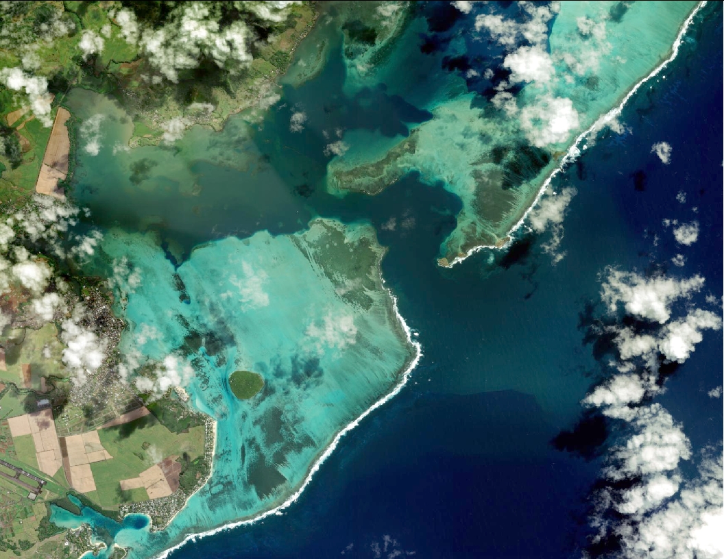
So, let’s start at the beginning, and take a look at a pre-incident high resolution optical image of the impacted area.
Mauritius has a mild tropical climate – a warm humid summer runs from November to April and a relatively cool, dry winter from June to September. The generally sunny conditions of Mauritius are therefore well-suited to optical satellite imagery, but this can be hampered by cloud cover. Across water, optical imagery can capture surface and below-surface features (depending on water clarity/turbidity and limited to a maximum depth). In some cases, understanding the characteristics of the subsurface features and their effect on wave patterns can be key to understanding information contained within satellite imagery. Additionally, and under the right conditions, it can provide insight into oil-type and thickness on the sea surface.
The pre-incident WorldView-2 image captured on July 16th holds significant value as a baseline. The image shows an unbroken outboard reef acting as a natural wave break, with varying coverage of sand, coral and vegetation within the shallow water lagoon. The presence of Sargassum on this image is a key finding, as at lower spatial resolutions it can hamper the interpretation of thicker oil in optical imagery during a spill event.
Whilst public space agency satellite missions (e.g. Sentinel-1, Sentinel-2, Landsat-8) were already imaging the site through their systematic acquisition programmes, high spatial resolution imagery is almost exclusively the domain of commercial satellite operators. These missions tend to have greater flexibility in terms of rapid and frequent image capture, but typically require custom tasking in order to capture imagery across a specific site of interest. During/after emergencies (both man-made and natural), many operators implement proactive tasking of impacted areas to support response efforts. This was the case for the Mauritius incident.
The agility of the very high resolution optical satellite missions available today is well demonstrated by the timely capture and regular revisit of the site during the incident by a number of satellite missions. The image sequence collected by the SkySat satellite constellation shows frequent revisits across the grounded vessel as it broke apart in mid-August.
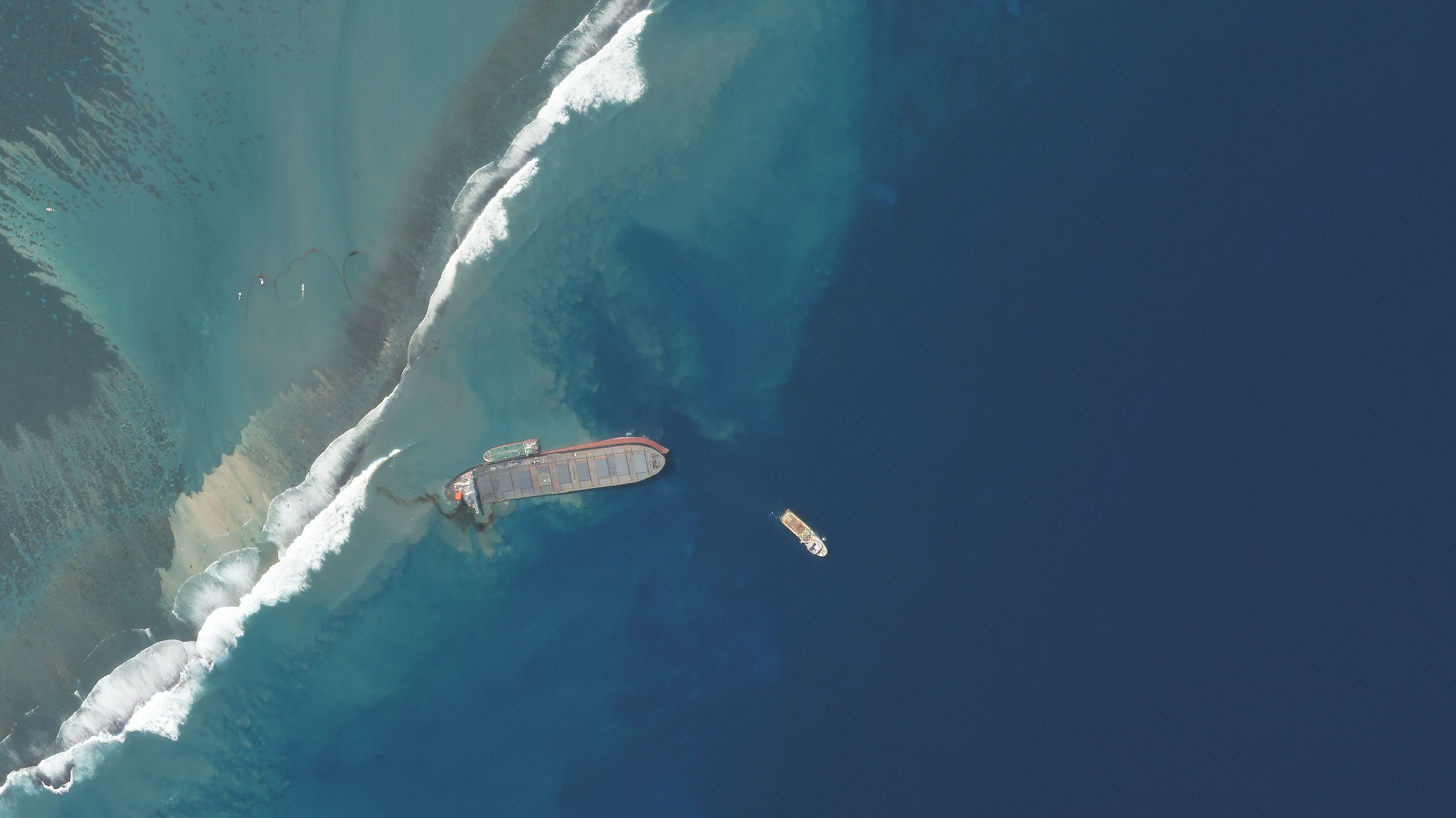
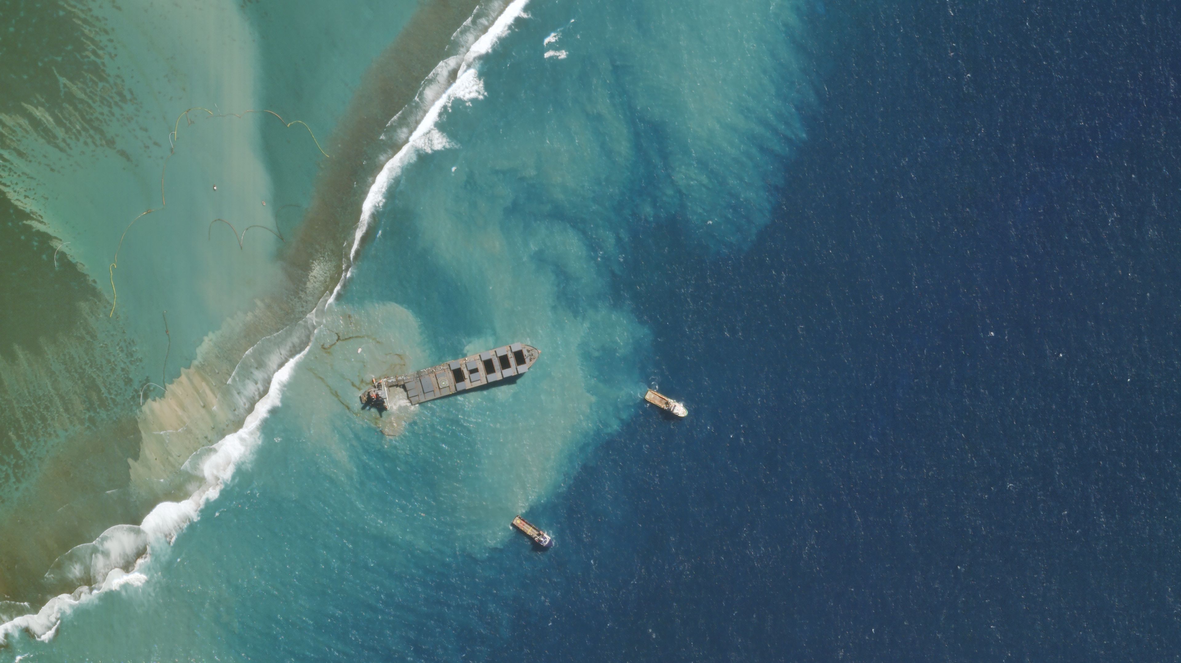
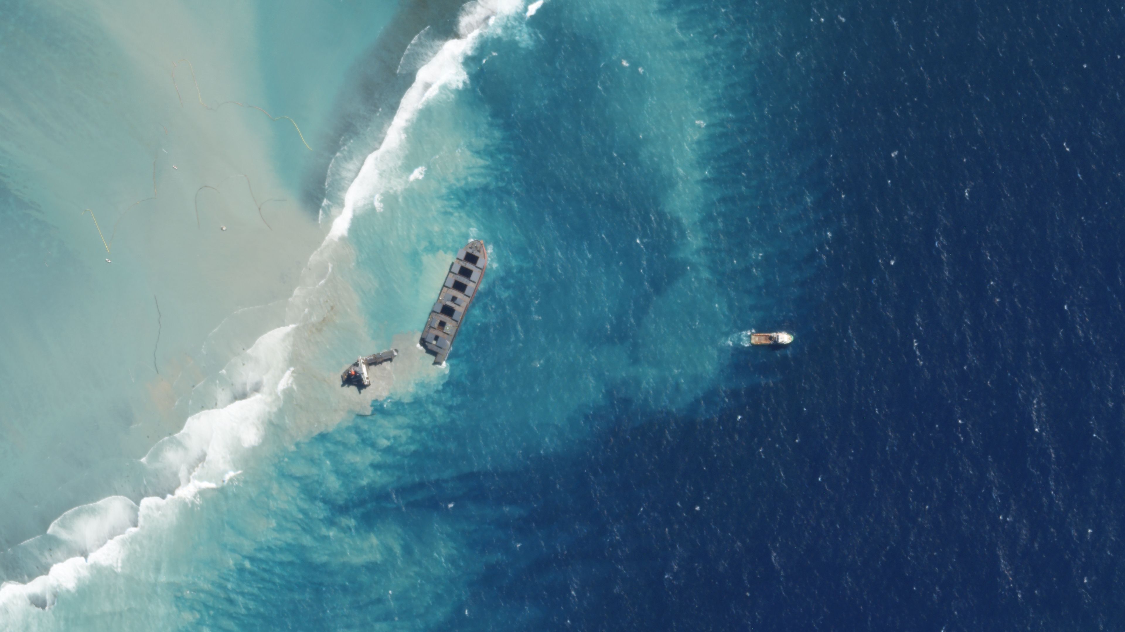
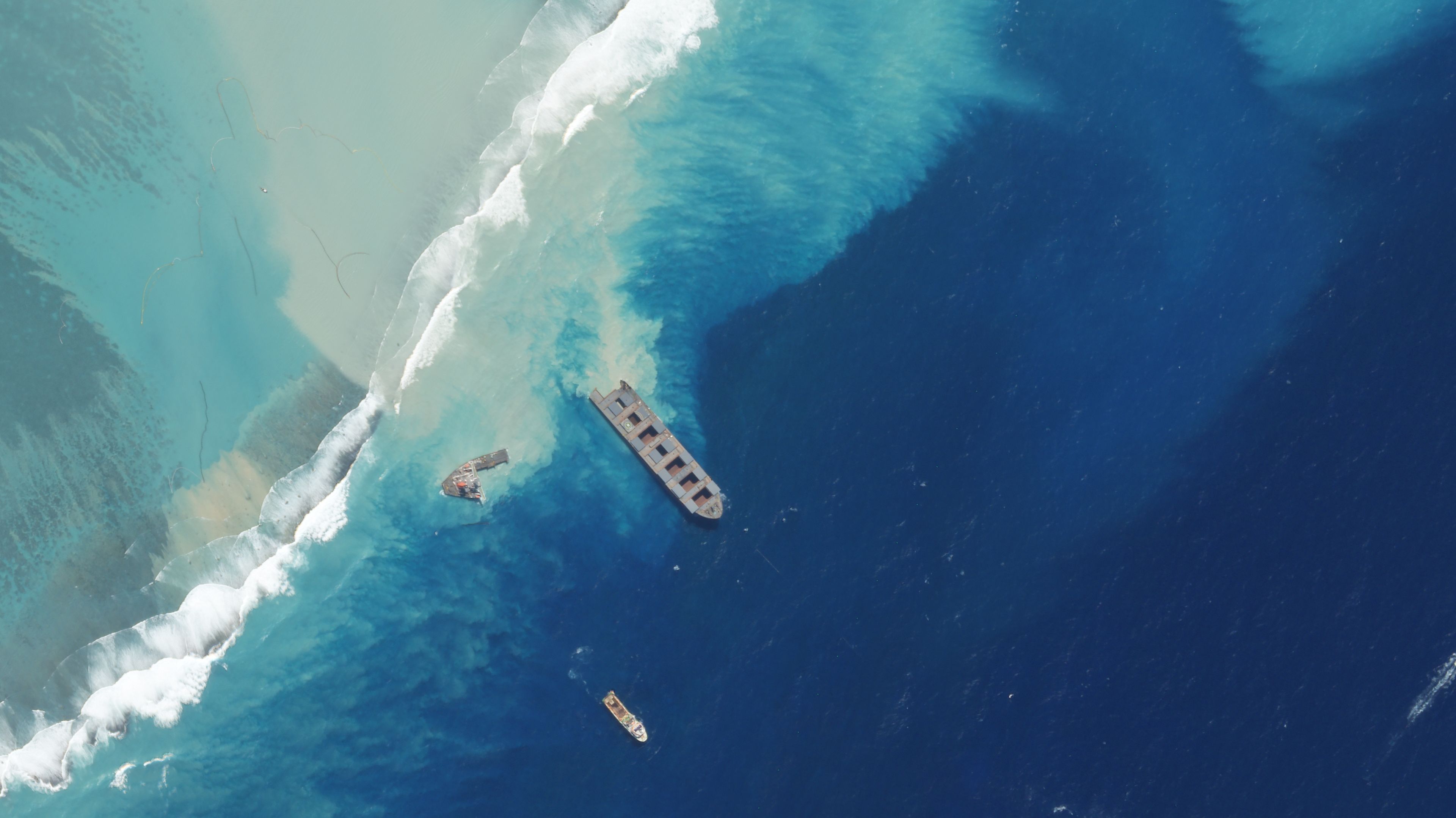
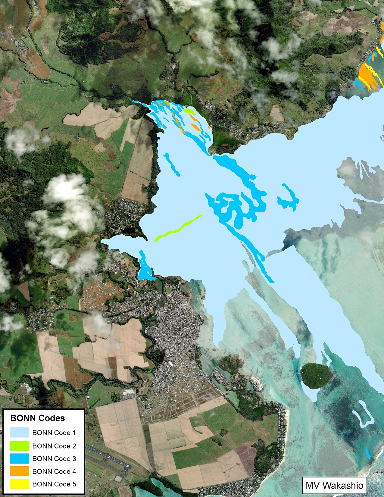
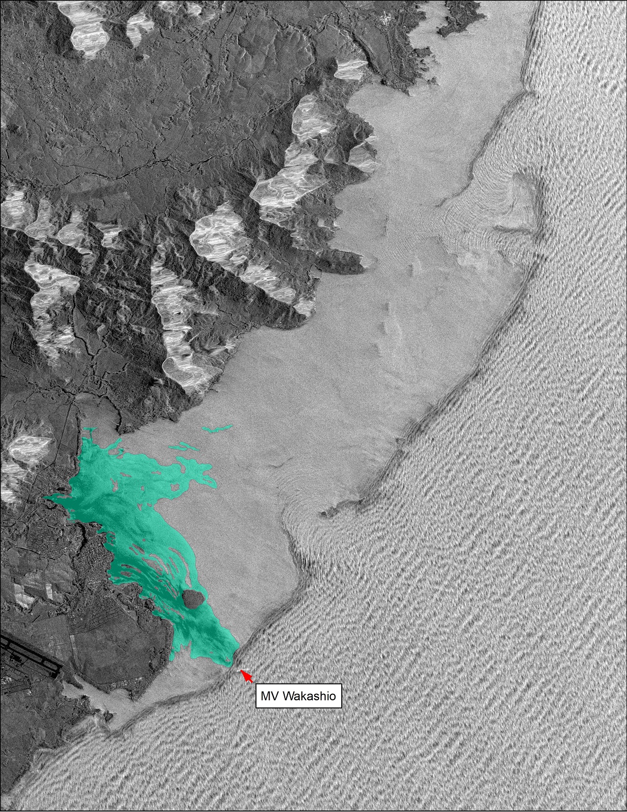
A WorldView-2 image captured on August 12th shows the spread of the oil spill six days after the vessel was reported to be leaking, highlighting the scale of the incident. CGG's expert interpretation of this imagery using the BONN Agreement Oil Appearance Code enables the differentiation of different surface thicknesses of oil - useful intelligence for establishing oil extent and targeting response efforts. In this case, approximately 85% of the spilled volume of oil is constrained to approximately 1% of the total spill area. The oil booms that were deployed with the aim of controlling the spread and impact of oil are visible in this type of imagery.
To date, high spatial resolution optical imagery continues to be captured every few days across the study area by commercial satellites, including GeoEye-1, WorldView-2 and WorldView-3.
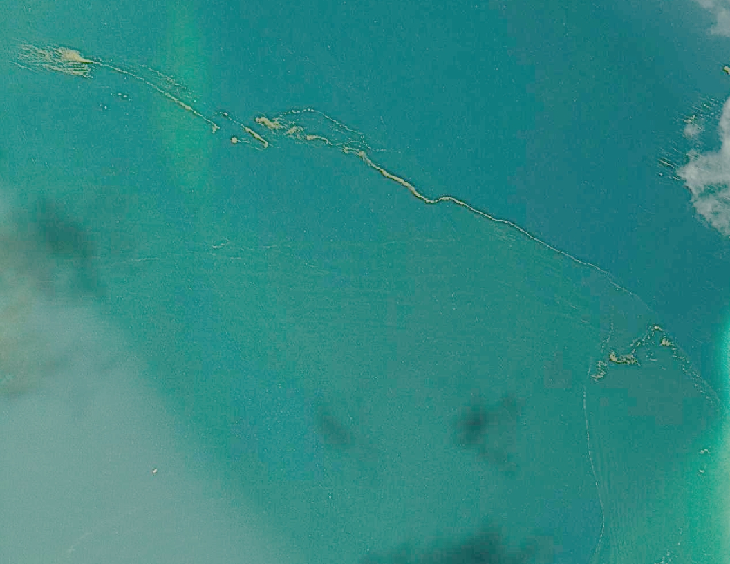
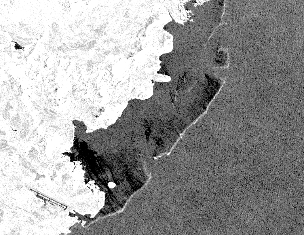
These optical image insights can be complemented, and in some cases exceeded, by the different perspective that SAR delivers. The impacts of oil on sea surface roughness can strongly influence radar response. Further, SAR has the benefit of imaging through clouds and at night. It is for these reasons that SAR imagery is often exploited within offshore pollution monitoring and incident response programmes. Expert processing and interpretation are however critical to deriving reliable information on sea surface features from SAR. Oil, like many other surfactants, dampens capillary waves on the ocean surface at lower windspeeds, enabling differentiation from areas of open water. This becomes more difficult in calm conditions and higher windspeeds when capillary waves fail to form or the oil is submerged by breaking waves, respectively. A good example of potentially ambiguous signals within SAR is demonstrated by reviewing a pre-incident Sentinel-1 image acquired on November 25th 2018. In this case, areas of low radar response are linked to the wind shielding impact of the reef, creating areas of calm and thus reduced radar backscatter in the lagoon, rather than the presence of oil or flow of hydrocarbons. Niche knowledge such as this is critical to delivering accurate classifications.
Commercial SAR satellites were also tasked during the incident. The Finnish company ICEYE is a relatively new player in the satellite market and their constellation of high spatial resolution SAR satellites is on the cusp of providing previously unobtainable levels of acquisition flexibility and revisit. Three X-band SAR satellites are operational today, with more planned for launch later in 2020.
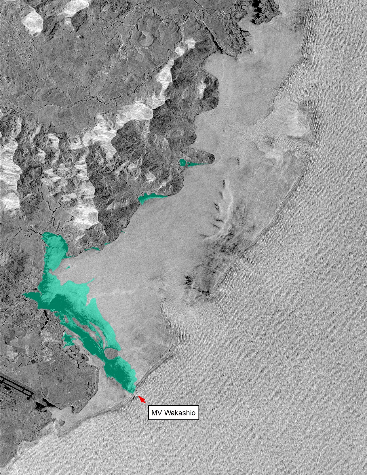
A series of 3 m spatial resolution SAR images were acquired during the event. Two images were captured on August 6th, the date MV Wakashio began leaking oil, at 18:33:23 UTC and 23:05:04 UTC respectively. The beaching of thick oil has been mapped on the lagoon surface first, with subsequent beaching evident in the image captured five hours later with less slick visible on open water. The August 11th image shows the wider spread of the slick. These images provide a useful comparison between what SAR and optical “see”.
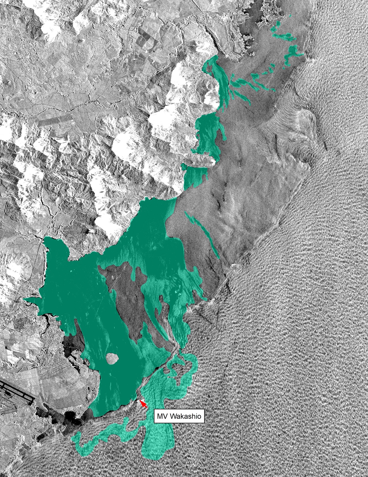
Compared to Sentinel-1, the benefits of ICEYE’s enhanced spatial resolution and frequent revisit capabilities across this relatively constrained area are clear. The systematic imaging by the same SAR instrument allows for a more consistent interpretation approach to be taken. Moreover, the incidence angles can be configured for the optimal detection of oil slicks on the sea surface. In addition, the high frequency of acquisitions allows for slick drift to be followed through time, a benefit only set to improve as ICEYE brings more satellites online.
The satellite response to this incident highlights the strengthening performance of of space technology, in particular the rapid response and unique insight that EO can provide. Procuring a diverse range of the most applicable satellite imagery is rarely straightforward, involving interaction with a mix of space agencies, commercial satellite operators and associated systems - CGG Satellite Mapping directly supports clients in navigating this complex landscape. In turn, a mix of knowledge, expertise and experience is critical to extracting credible and reliable information from satellite imagery against which operational decisions can be made - CGG Satellite Mapping has that mix, having worked in this niche domain for over 25 years, including data processing, expert interpretation and analysis of over 50,000 SAR images.
Header image © International Maritime Organisation
Email: satellite.info@cgg.com
Telephone: +44 (0)1732 865023
Website: www.cgg.com/satellite
LinkedIn: CGG Satellite Mapping
Twitter: @CGGsatellite