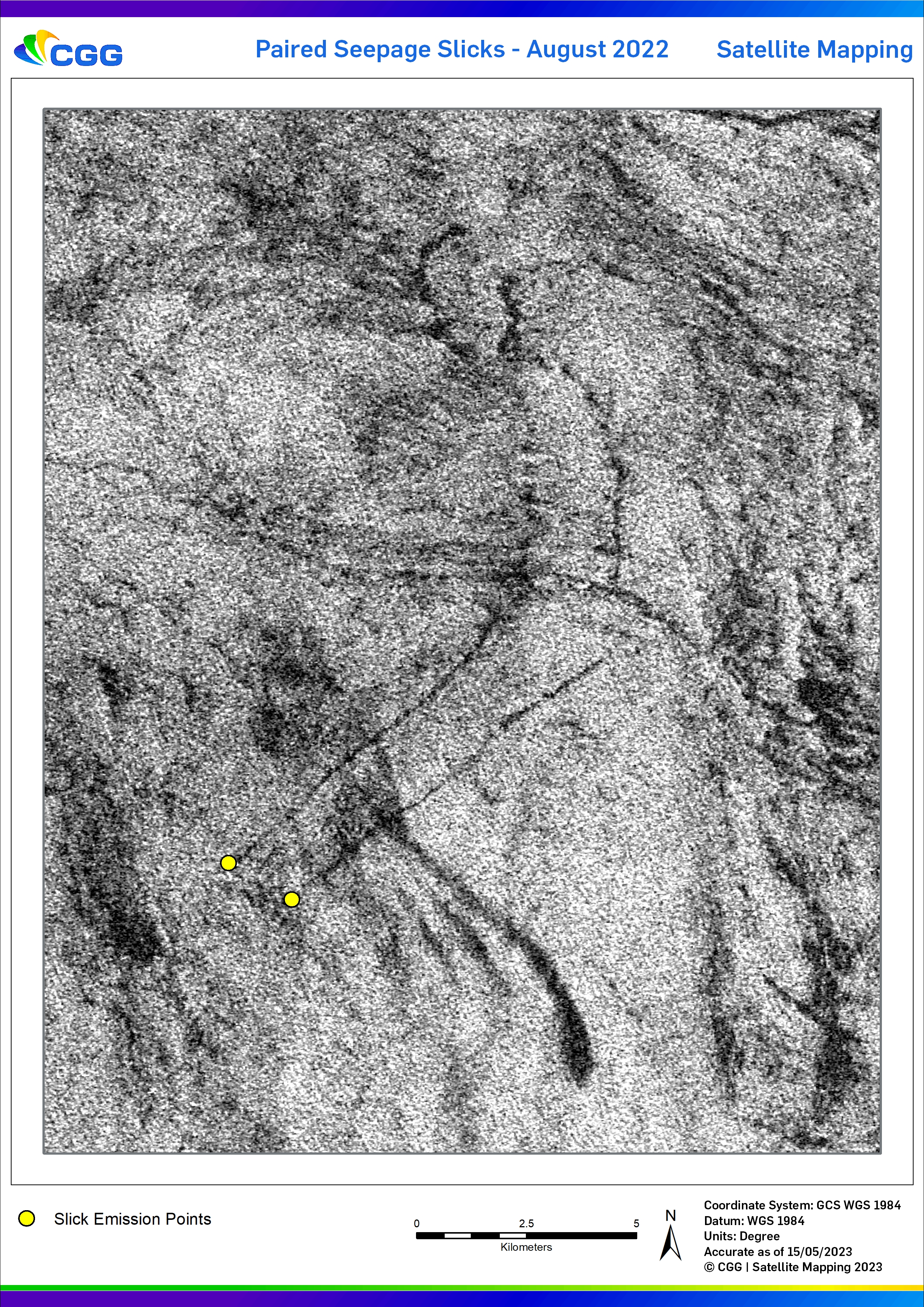
The Seep Hunting Team at CGG Satellite Mapping have undertaken a detailed study of the archive of satellite SAR (Synthetic Aperture Radar) data and multispectral optical imagery offshore Newfoundland, covering the Mesozoic St. Anthony, Orphan, and circum-Grand Banks sedimentary basins. This study not only includes the site of the current NL-23 licensing round, but also bp's high impact Ephesus well that was spud last week. Given the vast area on offer and the frontier nature of the region, offshore oil seepage hunting remains an excellent method for establishing petroleum system existence.
The key to unlocking the slick distribution across this area was targeting weather compliant scenes acquired in the summer months when variations in met ocean conditions lead to increased seepage activity, albeit these events are transient in nature. We utilize a unique detection technique that involves advanced processing and expert interpretation of Earth Observation (EO) data that enables confident identification and categorization of slicks on the ocean surface.
For more information on this site and the rest of our Canada dataset and its key deliverables, please get in touch with our Seep Hunting Team.
Email: satellite.info@cgg.com
Telephone: +44 (0)1732 865023
Website: www.cgg.com/satellite
LinkedIn: CGG Satellite Mapping
Twitter: @CGGsatellite