This short but fascinating article explores the use of InSAR (ground deformation surveying) across the Fukushima Nuclear Power Plant, Japan, and highlights interesting details relating to the decommissioning of the site in the aftermath of the 2011 earthquake that struck the country.
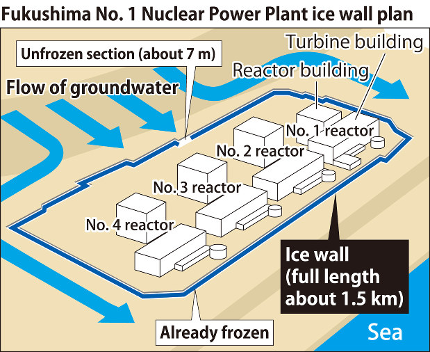
Shortly after the magnitude 9.0 earthquake and subsequent tsunami devastated the islands of Japan on the 11th of March 2011, the Fukushima Daiichi Nuclear Power Plant in Okuma, Fukushima Prefecture, was hit with a 'perfect storm' of operational malfunctions related to the natural disasters. During the four days that followed, loss of power to the coolant pumps caused three of the four nuclear reactors to go into meltdown. This caused a number of hydrogen explosions, releasing radioactive material into the surrounding environment. The melted nuclear fuel and containment vessel amalgam ('corium’), soon melted through the foundations of the power plant, ending up some distance between ground level and the water table.
The nuclear disaster was classified as a ‘Level 7 Event’ by the International Nuclear Event Scale; the only disaster other than Chernobyl to be given such a high rating. Japan and the Tokyo Electrical Power Company (TEPCo) were proactive in dealing with, and decommissioning, the defunct and hazardous nuclear site, with a clean-up timeline and planned work on the site continuing for up to 40 years.
Part of the clean-up process was to isolate the water-table around the nuclear reactor buildings to allow the continuation of pumping large amounts of cooling water into the unsealed corium, without leeching out the then radioactive coolant to the surrounding region. This was achieved by constructing a man-made (subsurface) permafrost barrier around the reactor buildings. Construction started in March 2016 and was completed in September 2018.
An investigation into possible ground displacement around the Fukushima Plant was remotely conducted using persistent scatterer InSAR (PSI) of Sentinel-1 SAR imagery, spanning from October 2015 to October 2019. InSAR is a satellite remote sensing technique used to remotely detect ground and structure displacements. In this instance, a series of images collected over a four year period were used to construct a time series of displacement, the results of which can be seen in the two images below:
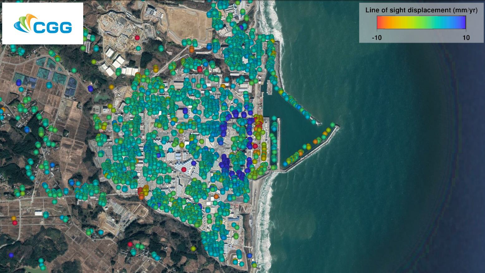
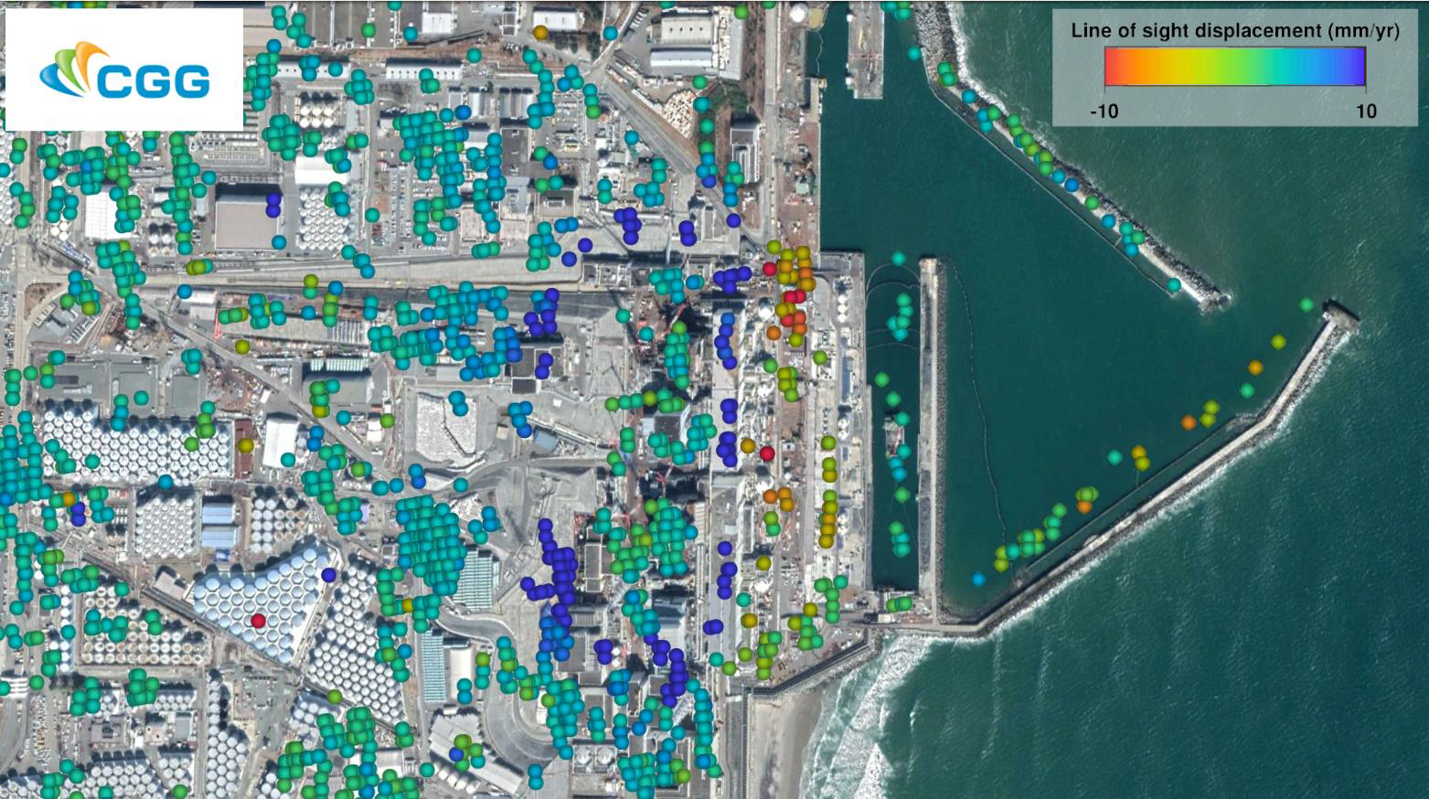
CGG's millimeter-precision InSAR measurements show a clear ‘ring’ of ground heave surrounding the four decommissioned nuclear reactors, representing up to 74 mm of displacement over four years (October 2015 to October 2019). This pattern coincides with work that TEPCo were conducting during decommissioning. Furthermore, a time series graph, for a single measurement point located within this heaving zone documents displacement linked to the engineering activities and shows the response of the ground (and associated buildings) to groundwater drainage, ground freezing and cessation of freezing.
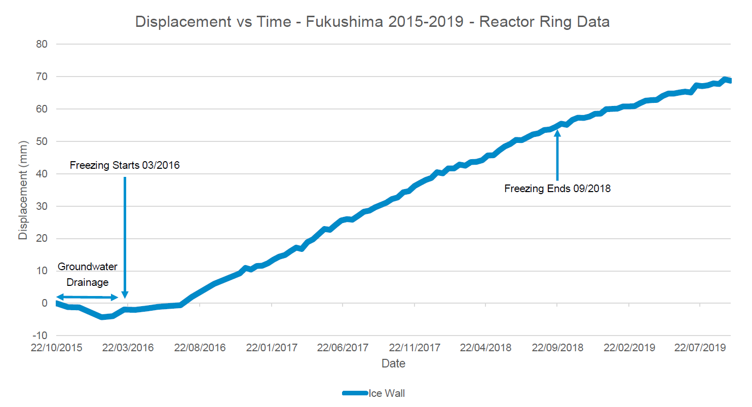
This study showcases the capability of remote InSAR surveying across operational and decommissioning power plants, and more specifically highlights that it is possible to precisely detect and monitor targeted engineering activities, such as freezing the ground to control radioactive pollution.
For more information on this work and the use of InSAR to derive remote surface deformation measurements across engineered structures, oil fields and mine sites, please visit: https://www.cgg.com/geoscience/satellite-mapping/insar or email satellite.info@cgg.com.
Title image copyright Maxar Technologies 2020, Terrametrics 2020, SIO, NOAA, U.S. Navy, NGA, GEBCO, Google 2020.