In response to the Jagersfontein TSF failure that occurred on September 11th 2022 experts from CGG's Satellite Mapping and Minerals & Mining teams have conducted a preliminary satellite imagery and InSAR review of the incident...
Summary
- The failure resulted in a substantial loss of tailings, stored from the processing of diamond bearing rocks. The highly fluid runout caused loss of life, injury and damage to critical infrastructure, houses, cars and farm land.
- As with most tailings failures, multiple factors are likely to have contributed to the incident. To understand these and establish causation requires a detailed forensic analysis by multidisciplinary experts, which will take place over the coming months. This is not the purpose of this review.
- In an assessment of initial satellite observations, w e highlight a number of pre and post failure features present across the TSF. We have also undertaken rapid initial satellite InSAR analysis across the TSF, capturing the status of ground stability prior to the failure (these data and associated measurements remain under review).
- The following preliminary observations have been made:
– The footprint of the TSF extended significantly between 2010 and 2017, with an entirely new cell being added to the west during this timeframe (data for
the intervening period are being sourced for review).
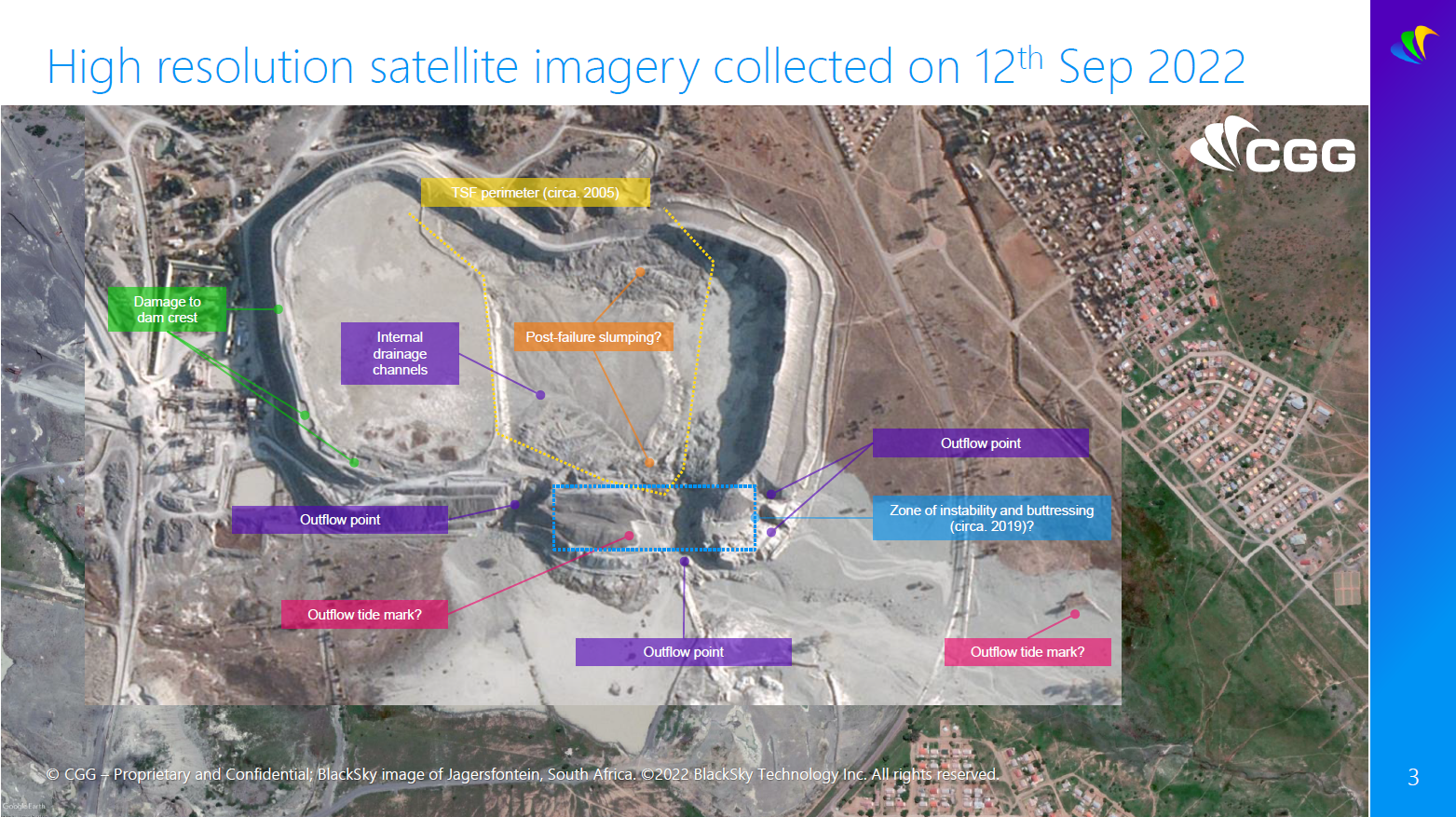
– In imagery from 2019, a possible failure or significant erosional event in the south east corner of the TSF is apparent.
– During 2019, there was construction activity that appears to relate to buttressing of the south eastern section of the TSF.
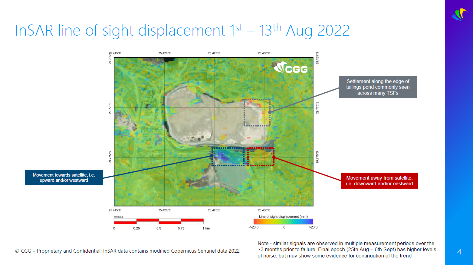
– Comparing satellite imagery with InSAR measurements, it appears that precursor displacement occurred along this buttressed section. One possible
mechanism of deformation that could be consistent with the observed InSAR signals might be outward bulging' of the dam prior to failure, with measured
displacements corresponding to outward east and west ward deformation.
– There is suggestion on social media that overtopping of the dam may have been a contributing factor to failure, but this is difficult to observe in imagery
currently available to CGG. It should be noted that satellite imagery prior to the failure indicates water ponded across the sur face of much of the TSF. - To the best of our knowledge, there were no significant rainfall or seismic events prior to the failure.
- Further updates will be issued in due course.
The above was compiled by Adam Thomas, Steven Edwards, Rachel Holley and Nathan Magnall at CGG. Should you require further information please contact us.
Email: satellite.info@cgg.com
Telephone: +44 (0)1732 865023
Website: www.cgg.com/satellite
LinkedIn: CGG Satellite Mapping
Twitter: @CGGsatellite