Imagery acquired by the European Space Agency’s (ESA’s) Sentinel-2 satellite provides a unique insight into the recent Norilsk diesel spill on the Daldykan and Ambarnaya Rivers and Lake Pyasino in the Russian Arctic.
Developed by ESA, the Sentinel-2 satellite carries an instrument payload that samples 13 spectral bands (four bands at 10 m, six bands at 20 m and three bands at 60 m spatial resolution) to facilitate its key mission: land monitoring.
Downloaded and processed by CGG Satellite Mapping, two true-colour (bands 4, 3 and 2) images show the spread of the spill (the red floating diesel on top of the water) within the local environment across a 24-hour period from May 31st to June 1st.
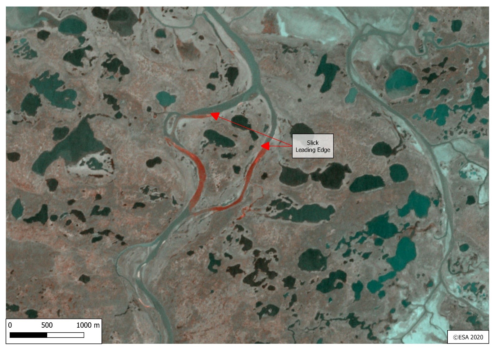
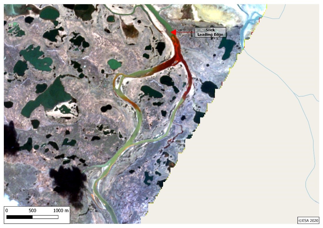
Such imagery provides important intelligence with respect to the identification of the slick itself and the delineation of its leading edge, which often contains thick concentrates of pollutant. On June 1st, the leading edge is observed downstream of the boom locations reported in a June 9th press release, highlighting that multiple acquisitions, and in particular access to the most recent imagery, can prove critical in making the best decisions. Beyond the initial body of oil in the main river channel, the drift of oil into smaller channels and lakes to the east is also observed, highlighting the increasingly complex evolution of the spill’s impact in this deltaic environment. By the time that the May 31st image was acquired the spill had already moved approximately 12 km downstream from the source of its release – vital intelligence for spill response teams. However, the available imagery provides minimal insight into the circumstances of the release itself, which has been attributed to subsidence of the supports surrounding a diesel fuel storage tank at a heat and power plant operated by Norilsk. One causal mechanism currently being considered is permafrost thawing associated with abnormally mild temperatures.
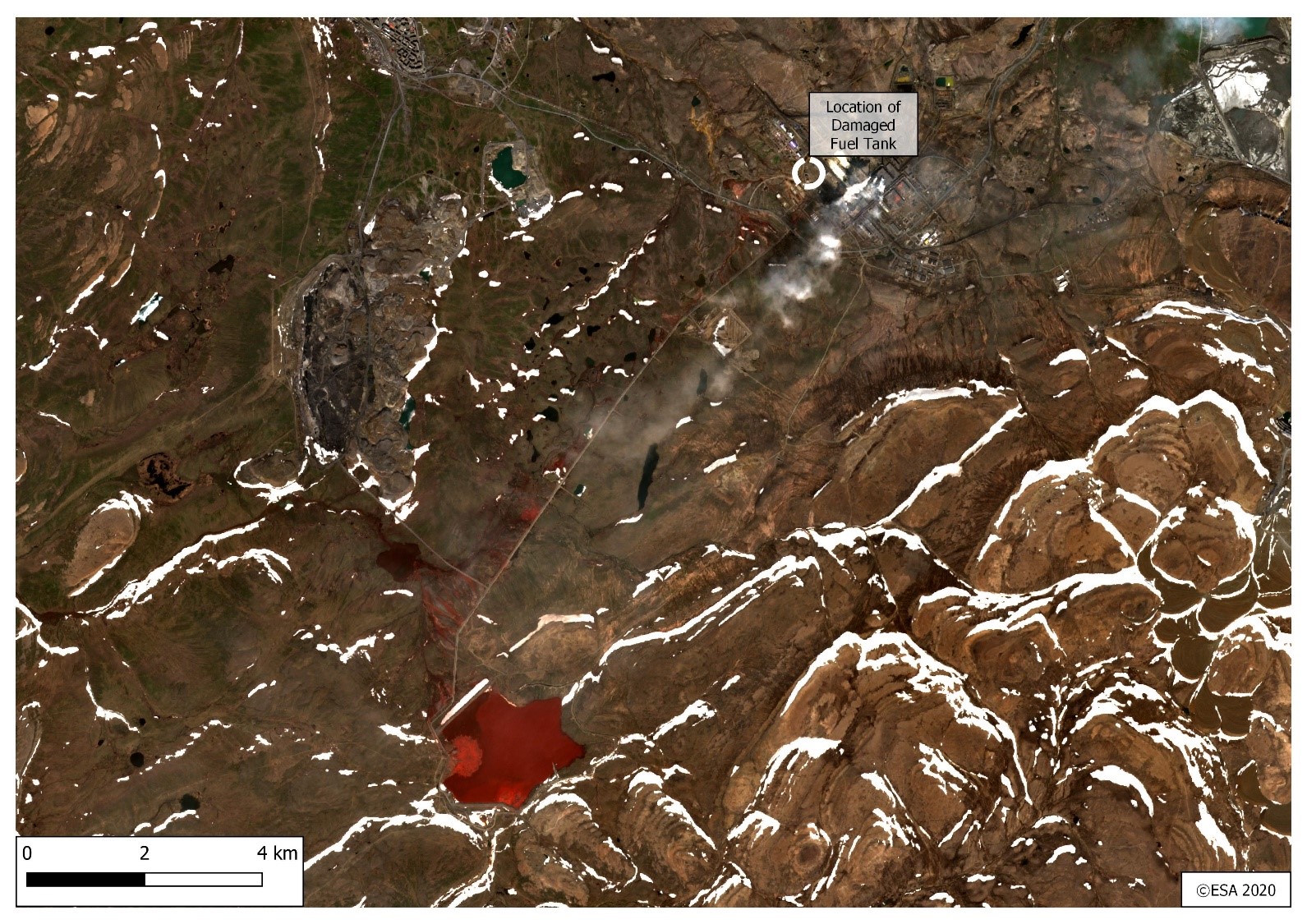
The wide area coverage and historical archives capabilities of satellite imagery enable the rapid examination of features of interest across a study area through time. Downstream from the spill imaged by the late May/early June 2020 imagery a Sentinel-2 image acquired on 8th June 2020 shows the Norilsk facility (the diesel fuel tank location has been labelled). A red pond to the south west of this is clear to see, which is linked to the local nickel mine. Red colouration can be observed draining away from a pipeline and access track that connects the lake and the facility, an area which falls within the catchment of the local river network. In September 2016 it was reported that the Daldykan river close to this site turned red (https://www.mining.com/norilsk-blood-red-river-runs/) linked to rain water flooding over a filtration dam (https://www.theguardian.com/cities/2016/sep/15/norilsk-red-river-russias-most-polluted-city-clean).
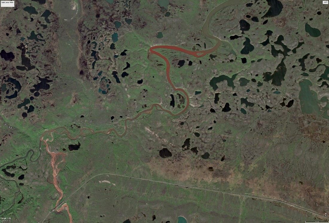
A very high spatial resolution WorldView-2 satellite image acquired on 25th June 2016 reveals a crimson colouration across parts of the same river system during a time of snow-melt.
Situational intelligence gathered by satellites can benefit site operators through both retrospective investigations and systematic monitoring, the latter of which supports proactive management (including early detection) and environmental due diligence commitments. Our team is uniquely positioned to provide multi-scale, multi-temporal remote intelligence across large industrial sites that deliver unparalleled insights into activity, infrastructure integrity, hazards, accidents and pollution incidents and their regional impacts.