This SeaScope blog post focuses on a long-term oil pollution event located in a region of legacy oil production and close to one of the world’s densest shipping lanes in South-East Asia.
First identified in a satellite image acquired on 24th December 2019, CGG experts have investigated the event through the advanced processing and expert interpretation of a series of Synthetic Aperture Radar (SAR) and optical satellite images, detecting and classifying sea surface slicks through time. Over the past 17 months a slick extending up to 140 km in length has been persistently observed at this location.
Subsequent analysis has established that the slick likely originates from a single release point on the seabed, at a depth of approximately 100 m (328 ft) and spatially correlated with a decommissioned oil well. Due to the high sea surface temperatures and seasonally dependent surface currents in the region, the released oil has been observed extending 275 km, into the waters of multiple countries and a range of important marine and coastal ecosystems, including mangroves and coral reefs.
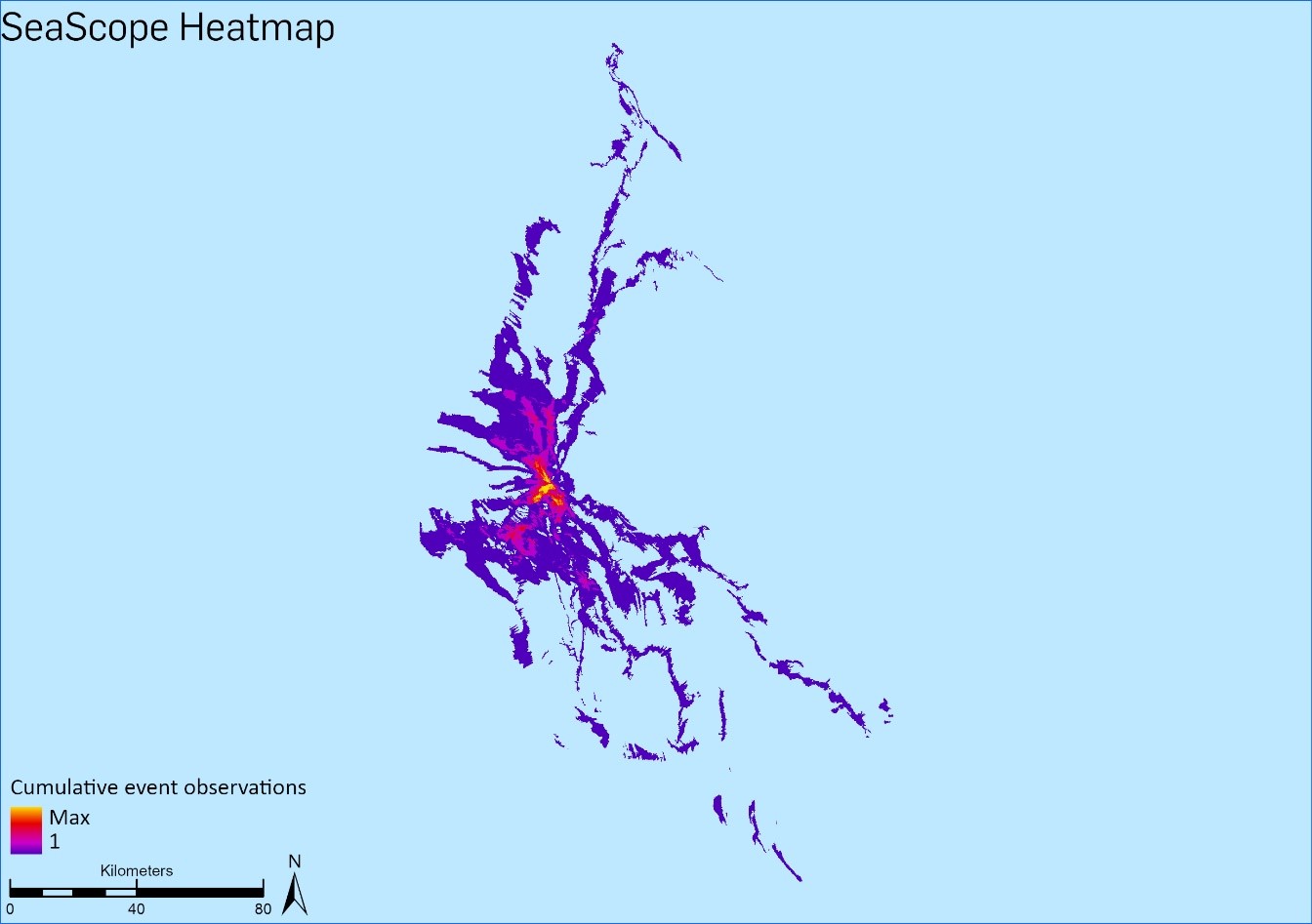
Based upon the SAR imagery derived results, assuming a consistent rate of release and 0.04 micron slick thickness, the minimum volume of oil that has entered the environment to date is estimated to be 3200 m3.
The presence of thicker oil (i.e. greater than 0.04 microns) throughout the slick has been identified in numerous cloud-free multi-spectral optical images. Expert interpretation of this imagery using the BONN Agreement Oil Appearance Code enables the differentiation of varying surface thicknesses of oil. The figure below provides examples from January 2020, February 2020 and March 2021.
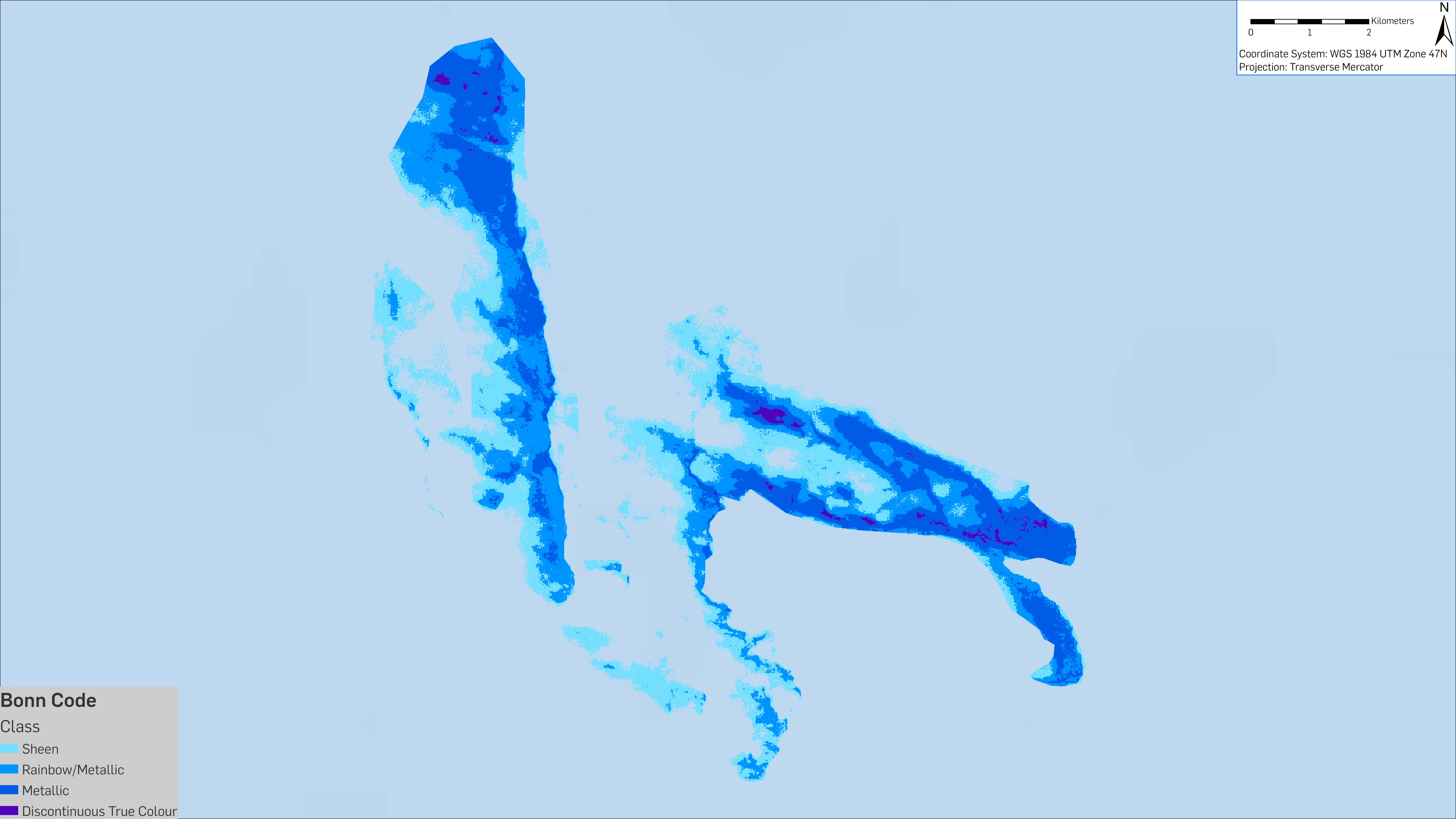
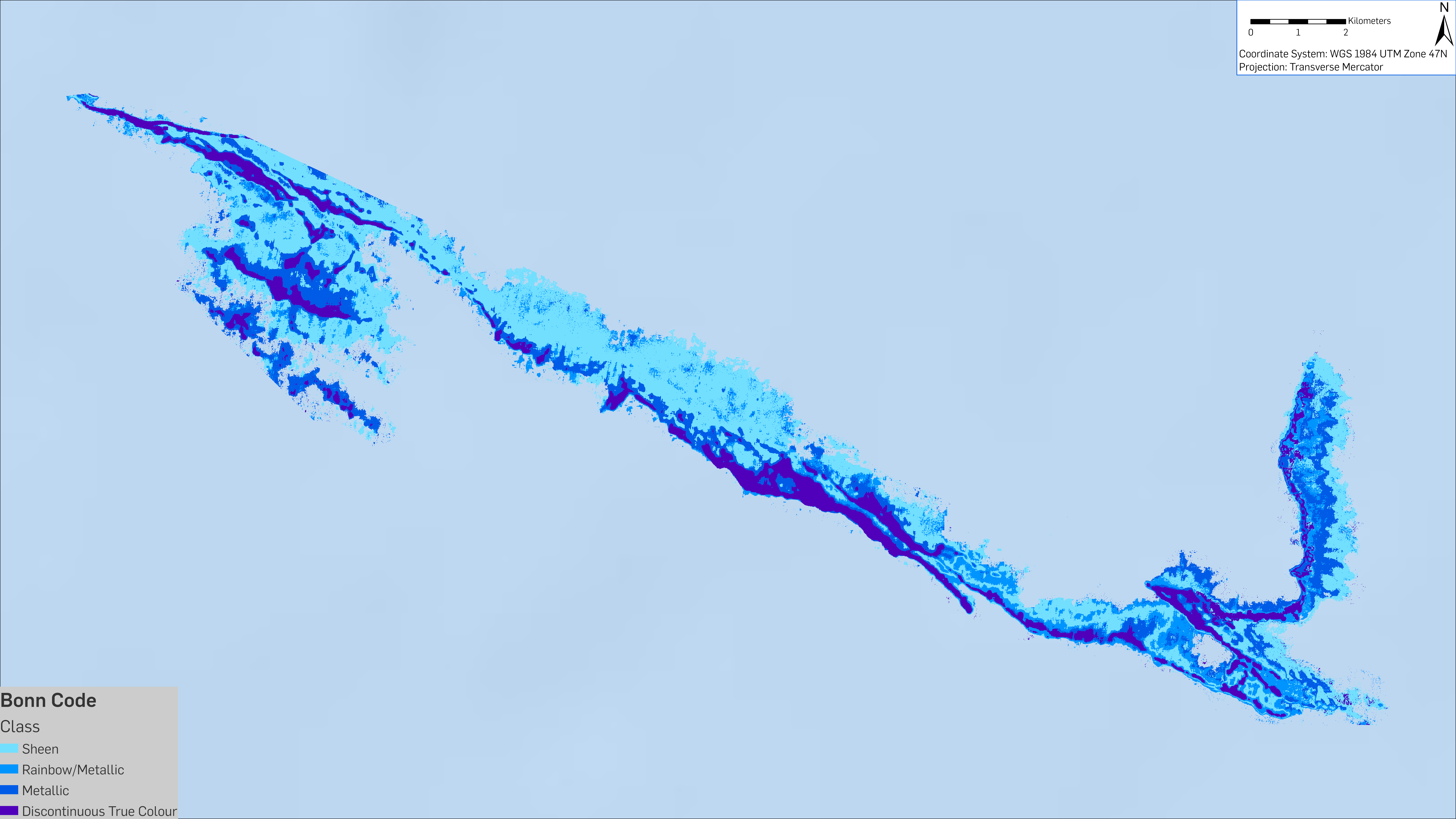
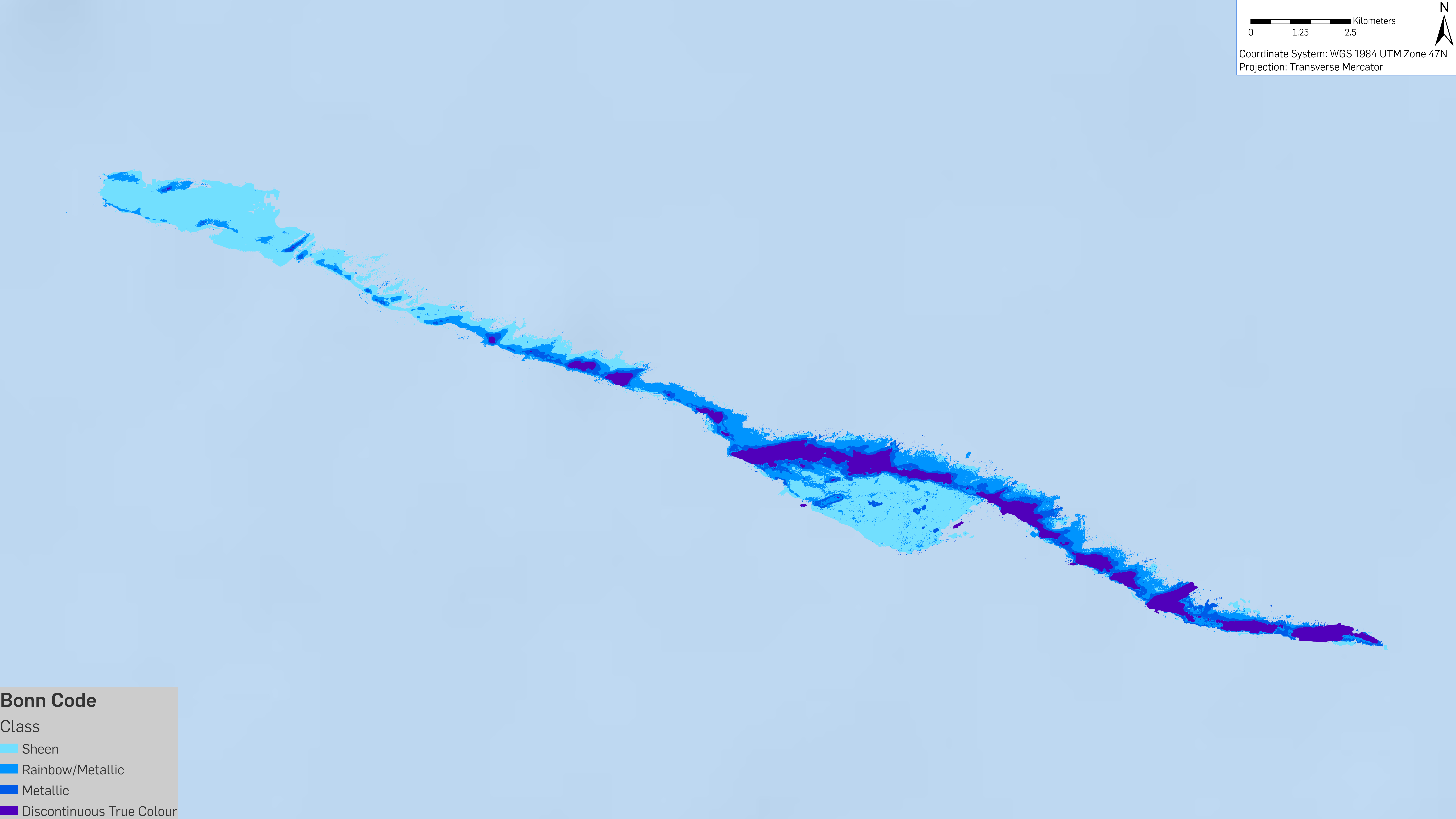
Volumetric calculations based up the BONN code classification for these three dates suggests that the total volume of oil spilled to date likely far exceeds the SAR imagery derived minimum estimate.
| Bonn Code | Oil volume on 07/01/2020 | Oil volume on 26/02/2020 | Oil volume on 02/03/2021 |
|---|---|---|---|
| Sheen | 1 m3 | 0.5 m3 | 0.5 m3 |
| Rainbow/Metallic | 2.5 m3 | 2.5 m3 | 3 m3 |
| Matallic | 56.5 m3 | 18 m3 | 42 m3 |
| Discontinuous True Colour | 378 m3 | 249.5 m3 | 18.5 m3 |
| TOTAL | 438 m3 | 270.5 m3 | 64 m3 |
Current regulation surrounding decommissioning and abandonment in this region is limited in scope and extent, with no requirement for regular monitoring of decommissioned oil and gas infrastructure. The nature of the event clearly demonstrates that legacy infrastructure is experiencing integrity issues. CGG has reported the event and continues to monitor this active spill, which poses an ongoing threat to the local environment alongside inevitable knock-on socio-economic impacts.
The ability to detect and monitor events such as this is underpinned by recent advances in Earth observation technology that today sees more of the Earth’s surface being imaged at a higher frequency and resolution than ever before. Expert processing, interpretation and analysis is critical in converting this step-change in imaging capabilities into intelligence capable of providing early detection and qualification of sea surface slicks that have previously gone either unreported or undetected.
This backdrop, and incidents such as this, were key drivers behind the development of CGG’s new SeaScope solution. SeaScope expertly detects and classifies sea surface slicks around offshore oil and gas assets across the world. The proactive monitoring delivered by SeaScope provides critical intelligence to strengthen situational awareness, showcase responsible operations and mitigate offshore pollution risk, delivering greater visibility of the interaction between active and decommissioned assets and the local marine environment.
If SeaScope can assist you in monitoring your global offshore asset portfolio, please get in touch. More information on SeaScope can be found on our website.
Email: satellite.info@cgg.com
Telephone: +44 (0)1732 865023
Website: www.cgg.com/satellite
LinkedIn: CGG Satellite Mapping
Twitter: @CGGsatellite