Satellite InSAR is a fantastic technique capable of detecting ground movements as small as 2 mm per year. This sensitivity, ability to work entirely remotely, and high measurement density means that the technique has seen huge adoption by many industries over recent years. Applications include identifying the subsidence due to oil extraction, determining the impact of tunnelling beneath cities, and monitoring slope instabilities due to mining. However, InSAR is by no means a panacea (contrary to what some marketing material would have you believe) and the technique can struggle across vegetated ground, can show periodic measurement loss due to construction activities, and cannot resolve areas of fast-moving ground deformation.
Large landslides pose substantial challenges in their identification, monitoring, and remediation. Landslides can occur due to natural phenomenon or due to human activity, such as mining or construction. InSAR has proven to be a powerful technique for identifying slow moving landslides, but often struggles to determine the magnitude of movement leading up to slope failure due to the rapid movement involved.
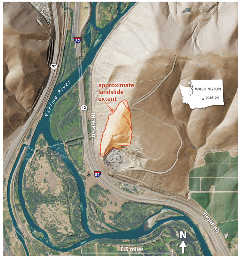
The Rattlesnake Ridge landslide is a large landslide located in the state of Washington, USA. Movement was first identified on the landslide in 2017 and since then has continuously moved at rates exceeding 50 cm a week. The landslide has an estimated volume of 3 million cubic meters and were it to catastrophically fail would destroy a section of the I-82 highway and the Anderson Quarry.
To test our ability to monitor such rapid moving landslides we ran our expert InSAR workflow across the Rattlesnake Ridge Landside using 1 m resolution TerraSAR-X Spotlight imagery acquired in 2018. Unsurprisingly, while InSAR could clearly show that something was going on in this area, it was not possible to determine the magnitude of movement. Instead, the result had a large number of what are known as unwrapping errors, essentially the movement was so great that the radar signal was jumbled-up beyond recognition. The failure to determine the amount of ground movement meant that another technique was required to quantify the magnitude of ground movement.
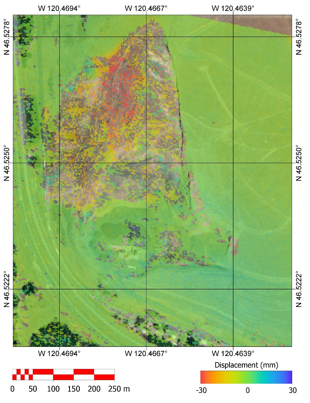
Pixel Offset Tracking techniques look for clusters of pixels that have moved laterally between two images. The technique uses the intensity data rather than the phase used in InSAR, meaning that Pixel Offset Tracking is much less sensitive but can measure much larger movements. As a general rule of thumb, Pixel Offset Tracking can detect lateral movement up to one tenth of a pixel size e.g., 1 m resolution SAR data would be able to identify 10 cm of movement between two dates. As can be seen below, the Pixel Offset Tracking technique was able to effectively detect the movement of the landslide between July and August 2018. Approximately 1-1.5 m of movement was detected, which is in-line with the 30 cm per week detected using GPS measurements at this time (https://www.dnr.wa.gov/rattlesnake-hills-landslide).
Pixel Offset Tracking provides two results showing movement relative to the azimuth, in this case NE-SW, and range, in this case NW-SE, of the satellite. In this example both results point toward overall south westerly movement of the landslide, with some possible rotation towards the south east at the toe of the landslide.
To summarise, while InSAR is an incredibly powerful tool for identifying ground movement, the technique struggles when movement rates are too high. Where movement rates are high it is possible to instead use Pixel Offset Tracking to determine the magnitude and direction of ground movement. By combining both InSAR and Pixel Offset Tracking a wider range of ground movement can be monitored.