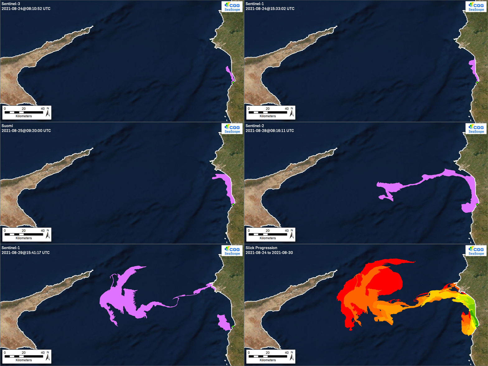
An update with the output of latest SeaScope analysis showing ongoing slick progression associated with the Baniyas oil spill spanning imagery captured between August 24th and 30th.

Previous blog post:
An update with the output of latest SeaScope analysis showing ongoing slick progression associated with the Baniyas oil spill spanning imagery captured between August 24th and 30th.

Previous blog post: