This blog post focusses on an active oil spill in the Eastern Mediterranean associated with the Baniyas Thermal Power Plant in Syria, and a recent tanker incident in the Back Sea...
Baniyas oil spill - August 24th
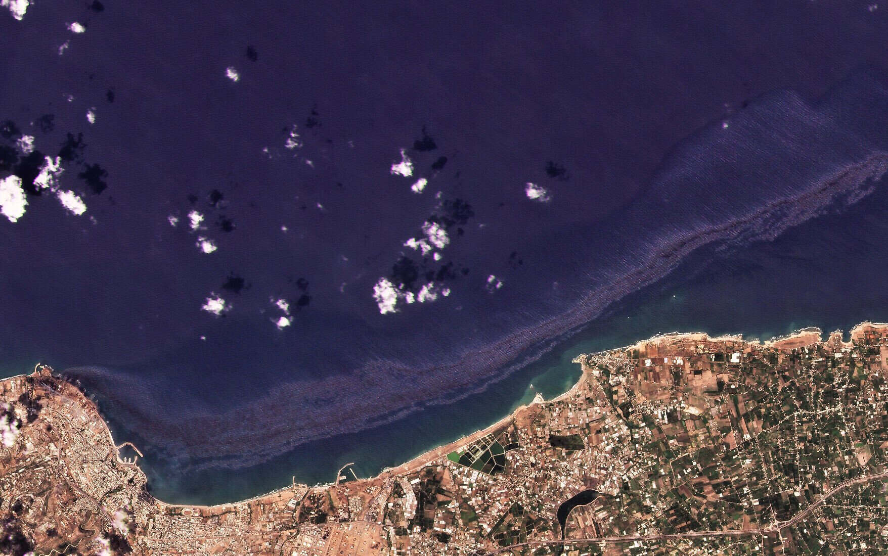
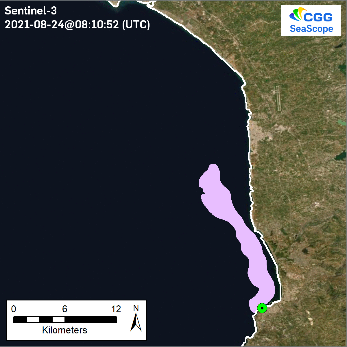
SeaScope continues to be utilised to monitor environmental issues in other parts of the world. The latest such issue being a large oil spill caused by a fuel leak at the Baniyas Thermal (Power) Station that continues to spread north along the Eastern Mediterranean coast of Syria. The first imagery showing the spill, believed to be from a cracked fuel tank, is on the 24th August.
PlanetScope imagery from the 24th August shows the varying thickness of the slicked oil across the length of the spill as it extends along the shoreline. The specification of this imagery allows for detailed, high-frequency monitoring of such spills, allowing for estimations of oil spill volumes to be made.
However, whilst much focus is given to the ever increasing array of flexible high-resolution satellite imagery commercially available (spanning both optical and SAR), it is important not to forget the value of open-access satellite imagery. This is especially true of the many programmes that when combined image the earth on a very frequent basis (albeit at lower spatial resolutions). That this event is visible on these images highlights the severity of the spill. This time-lapse animation combines imagery from the Copernicus Programme's Sentinel satellites (EC), the Earth Observing System (NASA) and the Joint Polar Satellite System (NOAA).
CGG's SeaScope solution can incorporate imagery from a wide range of providers and sources, allowing for wide area monitoring through to focused investigations.
This is adapted from a post first published on LinkedIn on August 27th.
Black Sea tanker incident - August 7th
Reflecting on an oil spill detected in the Black Sea in early August, our Offshore Interpretation Manager, Will Jeffery, commented:
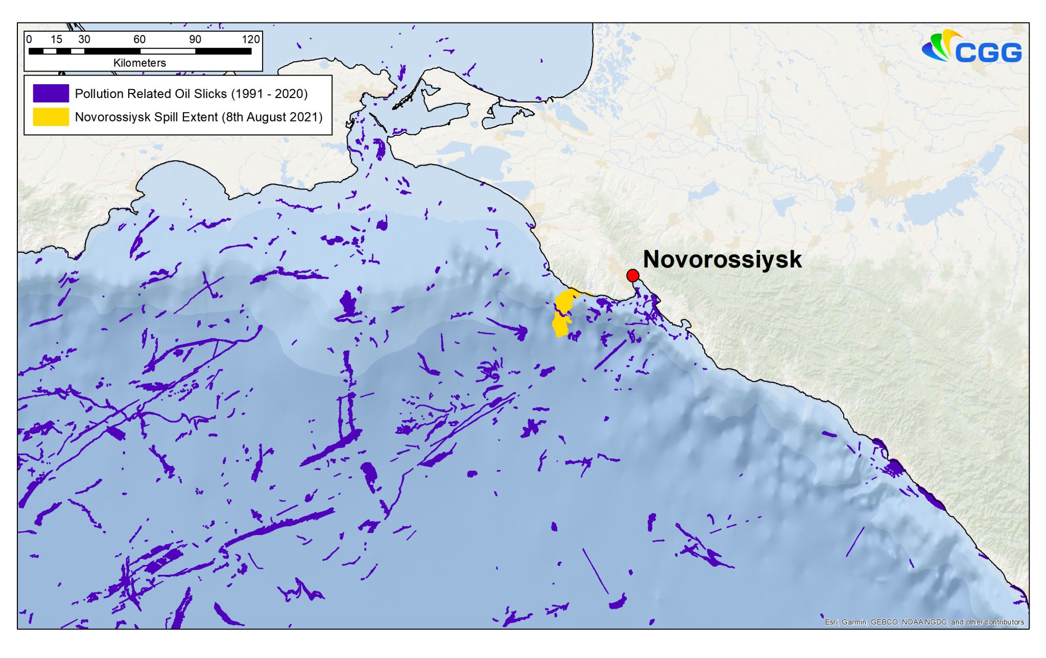
"The use of satellite imagery to establish the potential environmental impacts of a sizable oil spill in the Black Sea this month yet again highlights the value remote sensing has to play in environmental monitoring. However, publicly available open access satellite archives reveal that in fact there are many precedents for this type of incident in the Black Sea
Whilst only looking at tiny percentage of the available archive in this region, CGG has mapped over ~5200 pollution events in the Black Sea over the past 30 years, the vast majority of which are related to shipping activity. Whilst the identities of the vessels involved in these past incidents may be unknown, CGG's SeaScope can in the present provide timely evidence of such events as they occur allowing the identification and culpability of offending vessels to be known."
Thus is adapted from a post first published on LinkedIn.