Earlier this year we reported on the slick progression associated with the Baniyas oil spill derived from the expert processing, interpretation and analysis of a combination of Synthetic Aperture Radar (SAR) data and moderate and low resolution optical imagery acquired by a range of publicly operated satellites with open-access data policies. The growing number of commercial satellite constellations however provide exciting opportunities to significantly enhance the intelligence we are able to provide during such events.
Spacety's growing TY-SAR radar satellite constellation is an excellent example of this. One satellite (named HiSea-1) is in orbit today, with four more being built at present, and ambitious plans to grow the constellation further through 2022 and 2023. Each satellite has a 15-day repeat, and is capable of collecting 0.5 m resolution SAR imagery. This emerging capability is particular valuable for applications that require rapid, high-frequency monitoring.
Following the Baniyas Power Plant oil spill, HiSea-1 was tasked to acquire a mix of ScanSAR and StripMap mode C-band SAR data across the impacted area. The following graphics provides an example of the power of the new SAR data option that Spacety is bringing to the market.
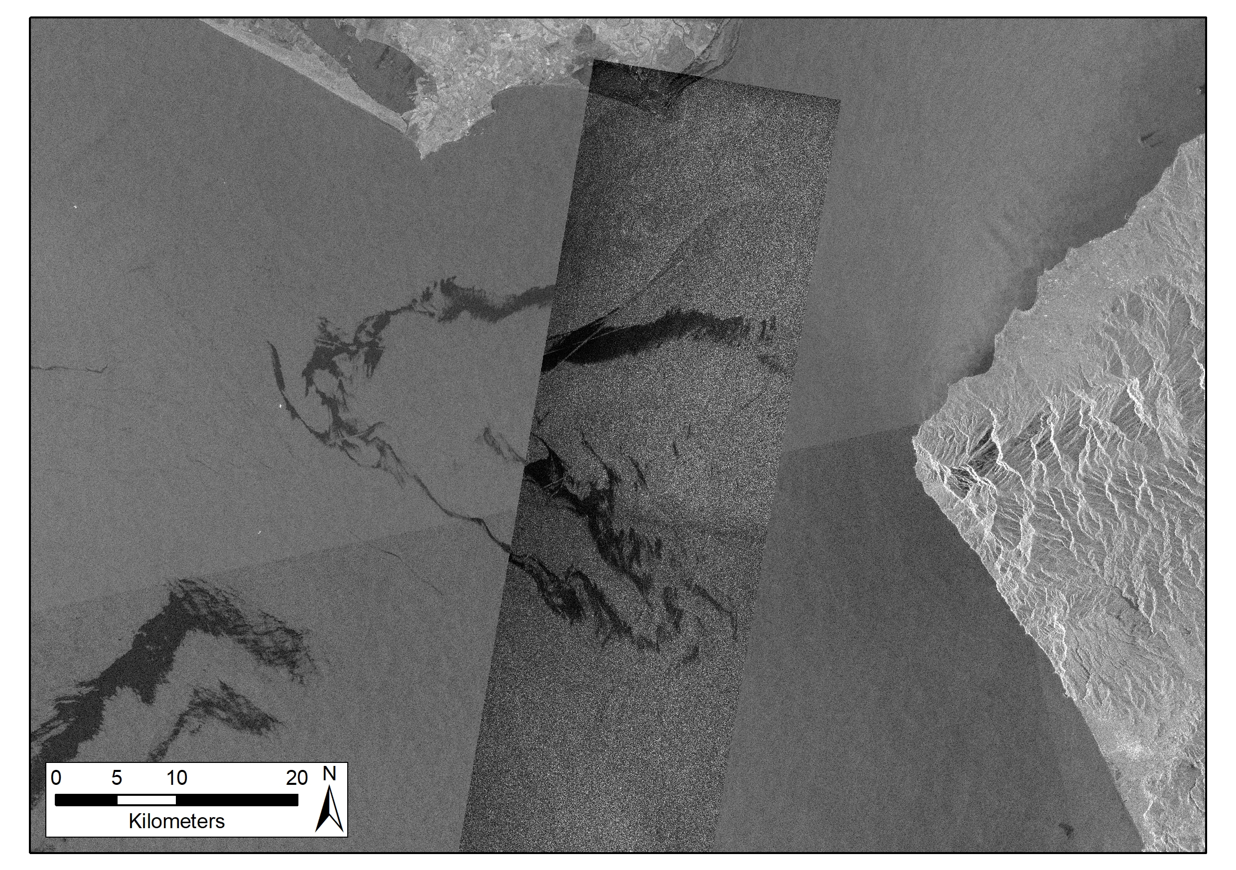
The left hand image below show a TY-SAR StripMap (3 m resolution) C-band radar image acquired at 09:51 overlain on a Sentinel-1 C-band radar image acquired at 15:33. The improved variation of backscatter throughout the body of the slick in the TY-SA image is clear to see. In the rare case of time coincident acquisitions, the damping ratios of such backscatter can be utilised to assess oil thickness.
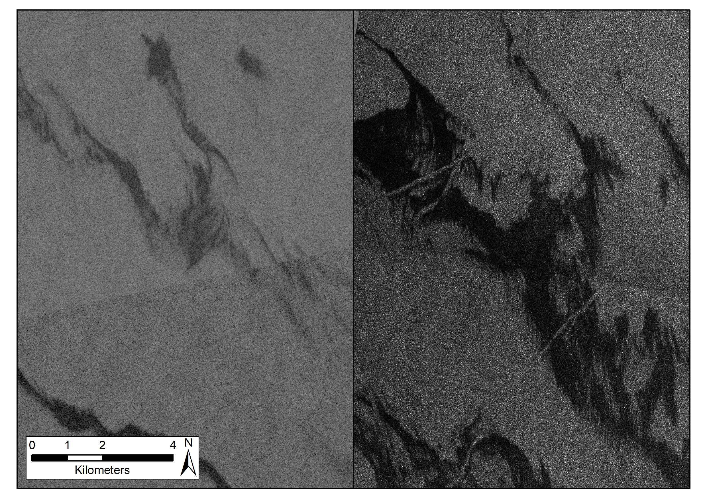
The right hand image below provide a side-by-side comparison of Sentinel-1 (left) and TY-SAR (right) across the same sub-region. Whilst there was a rise in windspeed on the day and the slicks drifted with time, the increased spatial detail is clear across the TY-SAR data. Note the vessel tracks traversing the slick associated with mechanical oil spill breakdown activities.
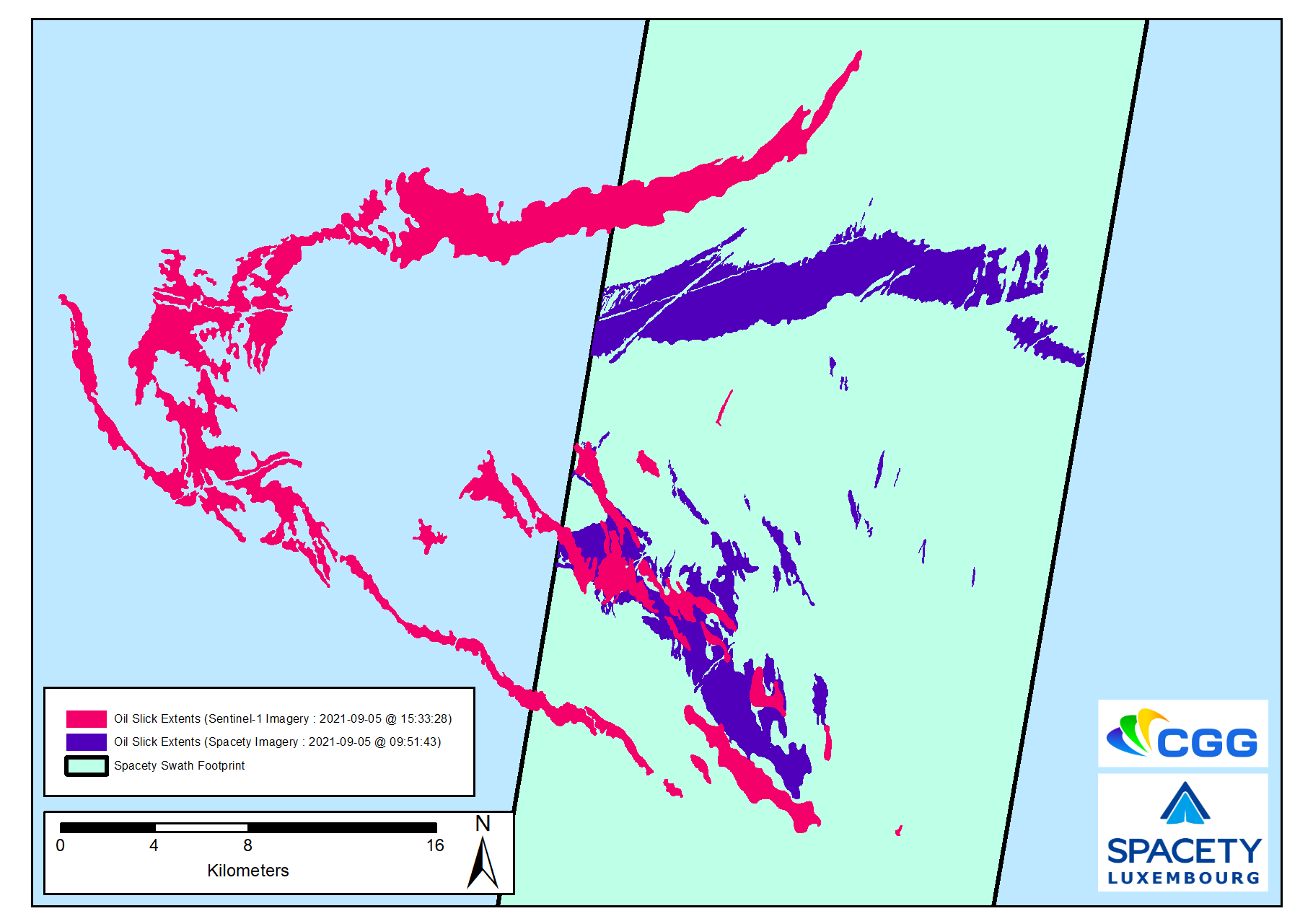
The image below shows the derived oil slick interpretation for the TY-SAR and Sentinel-1 images. The improved resolution allows for more detailed insights, which is particular exciting when considered in the context of future rapid tasking and data delivery across a very large satellite constellation.
The data that can be acquired by the growing TY-SAR constellation holds excellent potential from both a standalone and integrated data source monitoring perspective, significantly strengthening our ability to map and monitor key targets and features of interest with increasing power.
Our sincere thanks to Spacety for providing us with access to the TY-SAR data samples.